The final section of Horsey Way Cycleway in Eastbourne has been opened for consultation, and the plans in general are lacking in provisions for cyclists in all ways. The majority of the plan is to provide a widened footway and a few dropped kerbs in places to provide for cyclists, with it lacking in priority throughout and mixing with general traffic in much of the scheme. In comparison to the rest of Horsey Way, phase 1B is by far the worst.
The plans are open for consultation from the 16th August to the 24th September if you wish to make your comments.
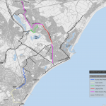
The Plan
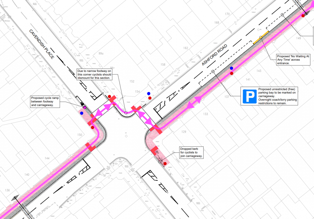
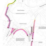
The way the cycle route interacts with this junction is the worst possible. Not only do cycles have to potentially wait for two traffic signal cycles to pass before continuing on their way, but they should also dismount between the crossings due to being narrow (maybe narrow within the highway boundary, but there is paved area between the highway boundary and buildings…)
What should be done here is have a single diagonal crossing (like a “scramble”) so cyclists only have to cross in a single phase. This should be possible to deliver within the highway boundary and without dismounting. There are also some places where cycles can join the carriageway from the cycleway.
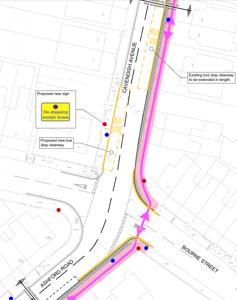
Ideally Bourne Street should get a raised crossing or closed off to motor vehicles as it provides parallel access as Cavendish Place, so it is redundant as a motor vehicular route.
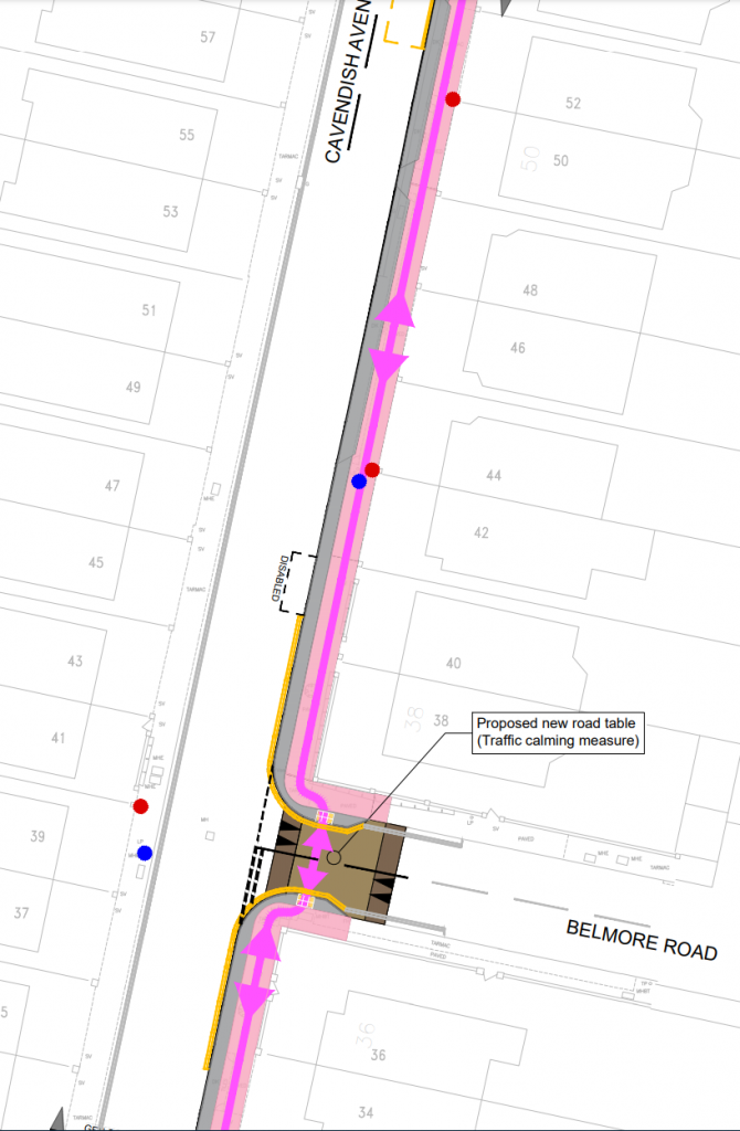
Due to geometrical constraints, it is hard to come up with a good solution here, but it would be better if the marked parking bays were replaced with a segregated cycle track, and a parallel crossing provided to cross over to the Western side for those traveling Northbound.
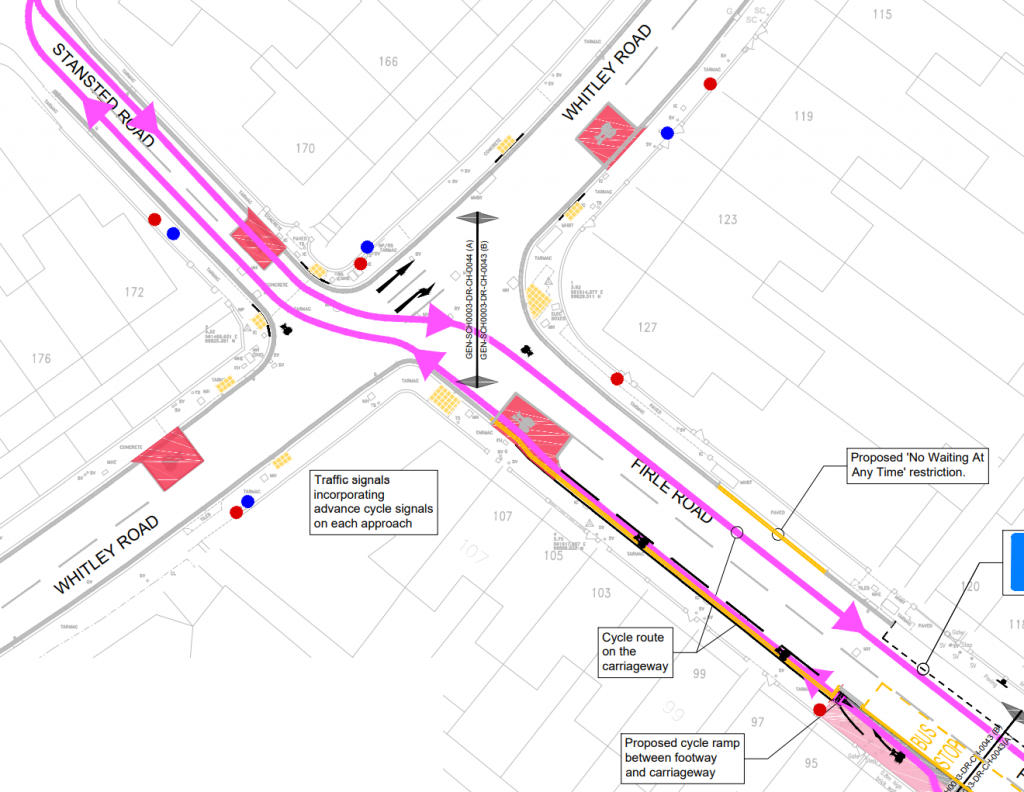
The traffic signals here were recently upgraded to include LLCS, although it is unclear if these will have an early green light for cyclists.
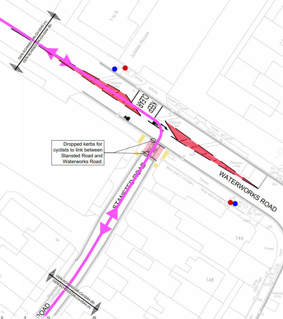
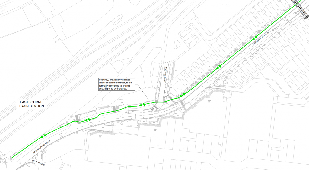
The route then follows Waterworks Road, Moy Road, Courtlands Road & Ringwood Road on carriageway with no cycle provision to meet with the rest of Horsey Way Cycleway.
Issues
Lack of segregation between pedestrians & cyclists
Where the route isn’t mixed with motor traffic, it is almost entirely mixed with pedestrians. This usually isn’t a problem in areas with minimal pedestrians such as in rural environments, however much of the shared use area would also be subjected to moderate levels of pedestrians. This is especially an issue as much of the cycleway isn’t proposed to be wider than 3m usually with adjacent boundary walls/fences on one side and parked cars on the other, making the actual useable with the of the cycleway less than 2 metres – just about enough for two cyclists/pedestrians to pass each other.
Lack of segregation from motor vehicles
Nearly half of the cycle route is on the main carriageway with motor vehicles, some of this is acceptable like on Stansted Road, however the section along Waterworks Road, Moy Road & Courtlands Road should be avoided.
Lack of priority at junctions
Along the 1.8km scheme, there are 10 junctions/side roads. Only 1 has cycle/foot priority across it (by giveway lines), 1 has a raised crossing with no priority and 2 are traffic signal controlled (1 as toucan, 1 as mixed traffic). There are 6 other crossings which have no improvement for cyclists or pedestrians. Some of these could be closed while the others should get either a parallel crossing and/or a raised crossing.
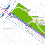
Ashford Road / Cavendish Place Junction
The arrangement of crossing twice and dismounting between the crossings is the worst attempt possible at this junction. It should be possible to provide one crossing diagonally across the junction which would fix both issues, the junction at the moment should operate as a single pedestrian crossing phase, so this would not negatively impact on any aspect.
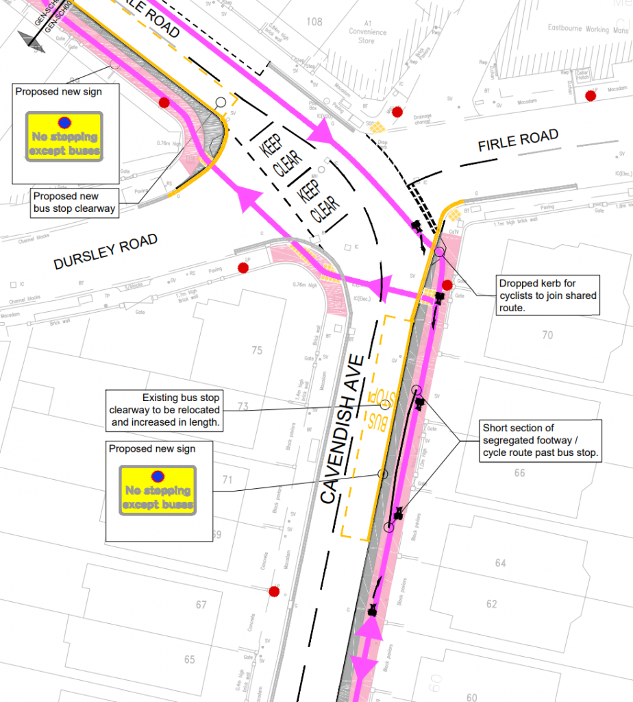
Firle Road arrangement
How both the Northbound and Southbound cycle routes interact with Firle Road is terrible. It should be possible to provide cycle provision going southbound by removing the parking spaces, and a better crossing to the other side of the road while going northbound is also possible by putting in a parallel crossing.