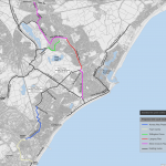
The currently signed cycle route between the Railway station and seafront is proposed to get some physical adjustments to make the cycle route better. Unfortunately nearly all of the cycle route is mixed traffic running along through route residential streets with cycle symbols drawn on the carriageway. However there are new parallel crossings proposed and a section of bi-directional cycle track.
Most of the route is of poor quality, where removal of parking could of resulted in a bi-directional segregated cycle route, instead the option to retaining parking and mixing traffic was chosen instead.
The plans are open for consultation from the 16th August to the 24th September if you wish to make your comments.
The Plan
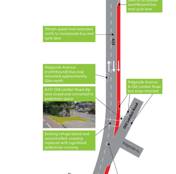
Some sections have been removed if there is nothing of interest to note.
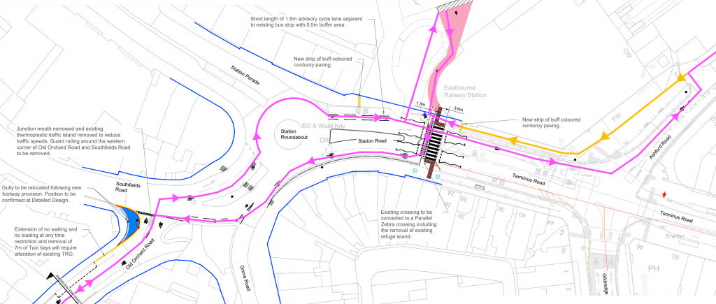
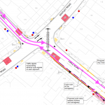
There is access to and from the station car park and beyond via a shared use area. Outside the station a new parallel crossing is to be provided, replacing a current unmarked crossing. The cycle part of this crossing appears to be minimal 1.5m allowed, however this shouldn’t be an issue since its only useable in one direction.
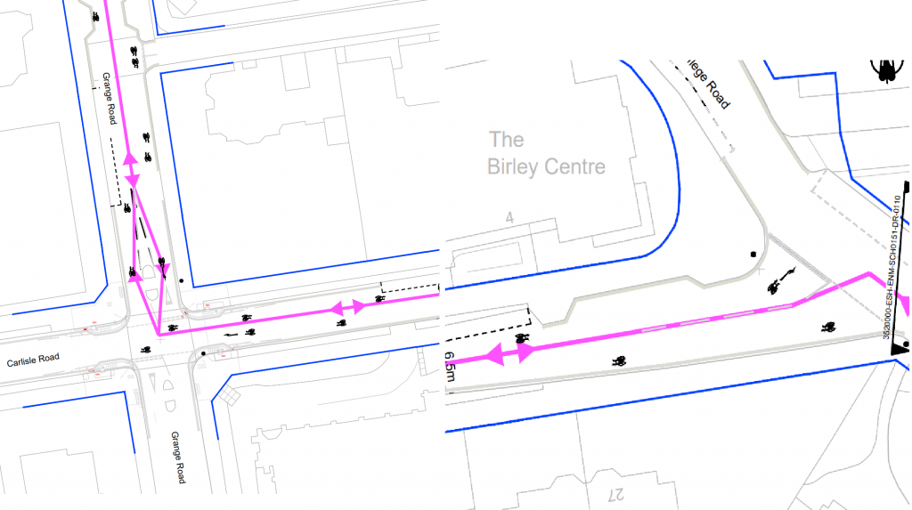
Cyclists in both directions then must remain on the carriageway around the roundabout which will have cycle symbols marked on it along with some short sections of advisory cycle lanes.
It then continues along Southfields Road before turning onto Old Orchard Road, again on the carriageway with cycle symbols marked on it. An issue I can see here is that heading south it encourages cyclists to take up the left side on approach to Grove Road (which is a busy road), which may lead to drivers dangerously passing as they cross over the diverge for Grove Road.
The junction of Southfields Road and Old Orchard Road will also be narrowed to improve the accessibility to pedestrians as well as lower motor vehicular speeds.
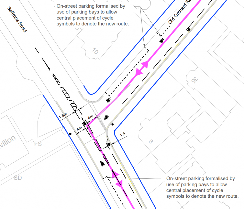
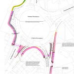
The route then turns onto Saffrons Road with an odd turn pocket (1.5m) put it. Cars are also able to use this turn, so how it is marked could cause confusion.
Turning pockets (1m) are also to be provided for cyclists, but again motor vehicles are able to use these as well.

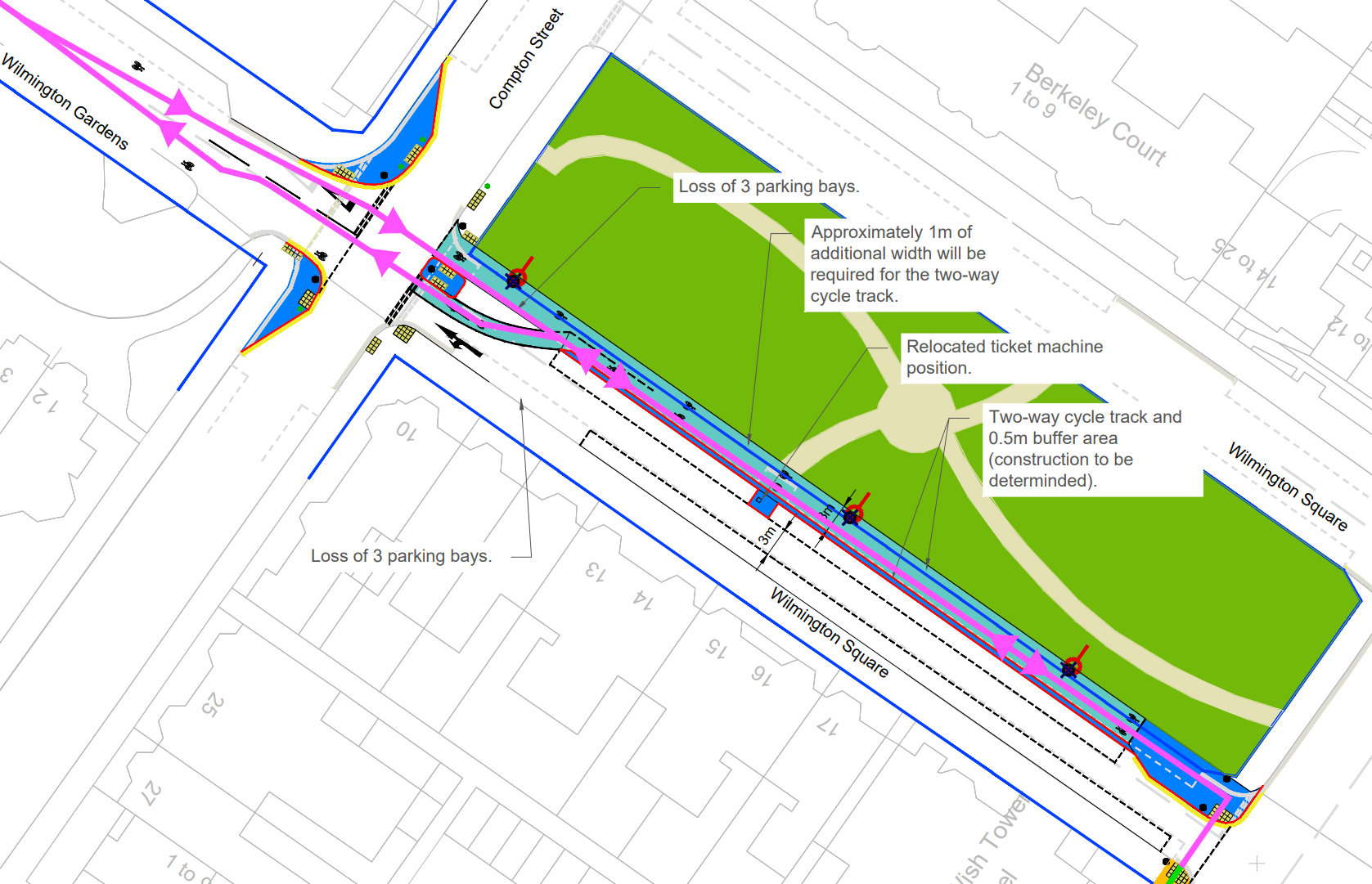
While this is the best piece of cycle infrasturue on the whole route, it isn’t well designed. Ideally none of the square’s grassy area should become part of the highway, this could be achieved by either making the cycle track one-way with cycle traffic in the other direction using the carriageway as that apparently isn’t an issue with the rest of the route. Or alternatively parking on one side could be removed entirely.
Also after parking a car there is no footway, instead having to use the cycleway or crossing the road.
The issues I see with the current plans is that the cycle part of it is only 1.5m wide, because it allows two-way cycle traffic it should be at least 2m wide (ideally 3m). Also the zigzags overlap with the marked parking bays.
Issues
Lack of segregation from motor vehicles
Most of the route shares space with motor vehicles, segregation is possible along the route by removing parking bays on one side of the road. Where there are cycle lanes they are only advisory and usually 1.5m wide.
Turning Pockets
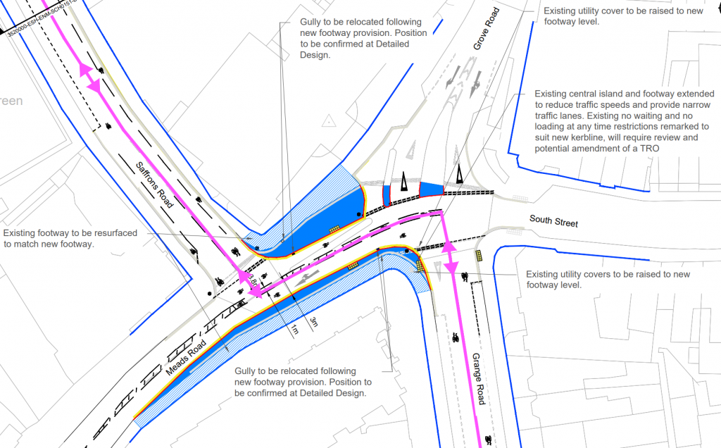
Turning pockets that are usable for all vehicles show the cycle symbol which may cause confusion. Also around Meads road it is only 1m wide which is not sufficient at all and could be wider since they are narrowing the carriageway here.
Dismount outside station
Having to dismount to use the route outside the station isn’t great. It is possible to remove one of the lanes on Terminus road and provide a bi-directional 3m lane instead.
Widening the Highway at Wilmington Square
The bi-directional cycle track at Wilmington Square removing about 1m of the square could be avoided by either removing the parking, or by making the track one-way as a contraflow with cycles using the main carriageway in the other direction.
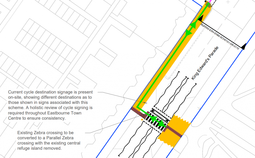
Parallel crossing on King Edward’s Parade
The parallel crossing has a narrow cycle crossing part which could cause issues for cyclists travelling in opposite directions. Could be widened to be sufficient width. Also zig zag markings overlap marked parking bays.