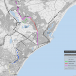
A new 5.5km cycle route between Stone Cross near Eastbourne and the seafront where it will join NCN21 has been opened for consultation. This is almost entirely off-road by either using a widened (3-4m) shared footway or a dedicated 3m cycleway. New & upgraded parallel and toucan crossings are also included within the plans. The route is made up for three distinct sections. North of Langney Road, Langney Road & South of Langney Road.-
The plans are open for consultation from the 16th August to the 24th September if you wish to make your comments.
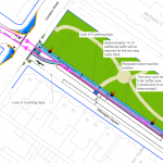
The Plans
There are over 40 individual sheets of plans for this scheme, I’ve skipped over the boring bits and glued others together so make viewing it as easy as possible.
North of Langney Rise
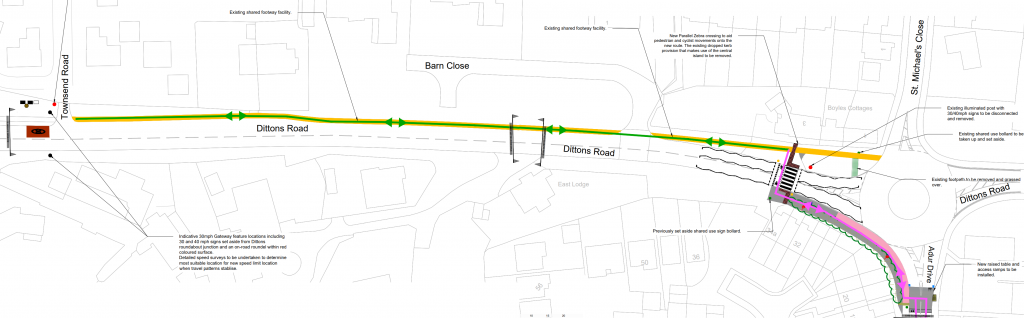
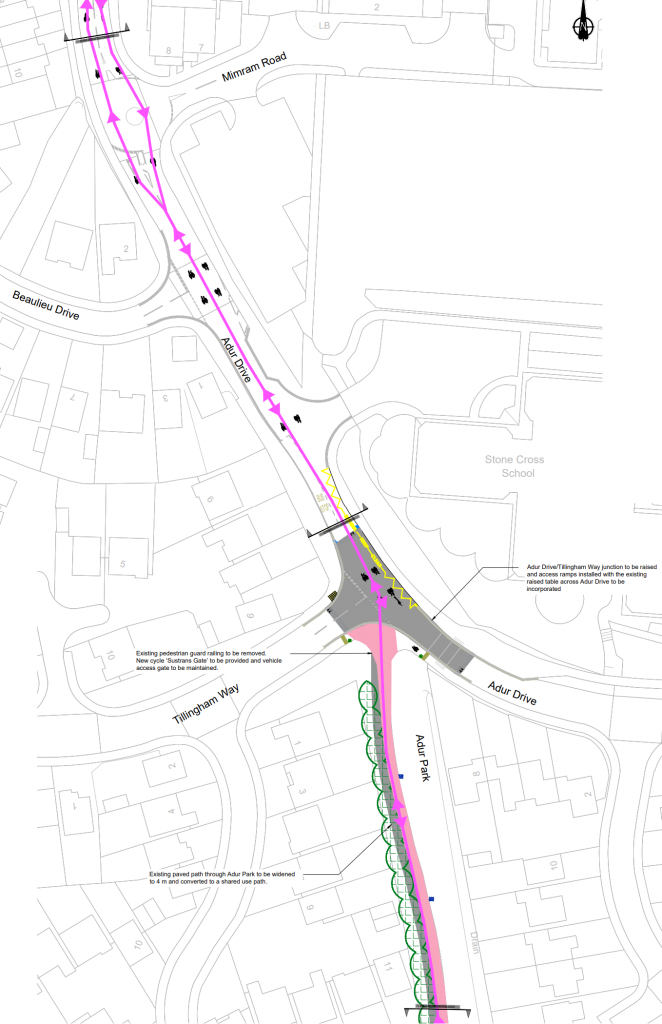
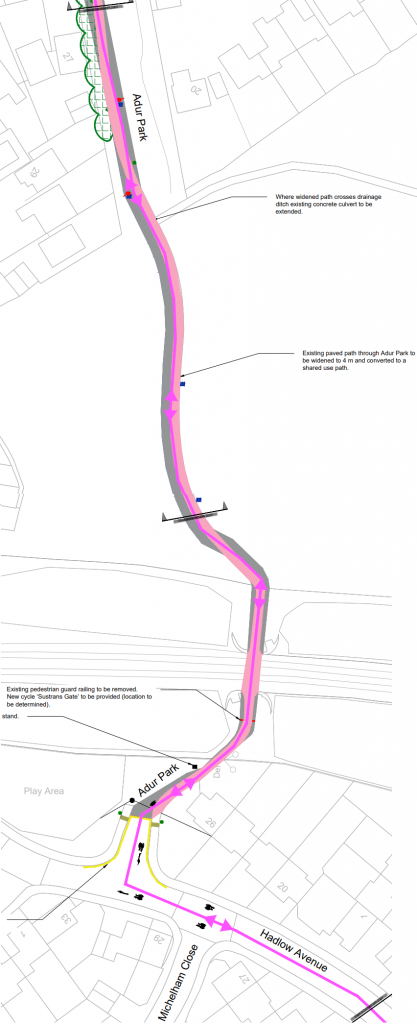
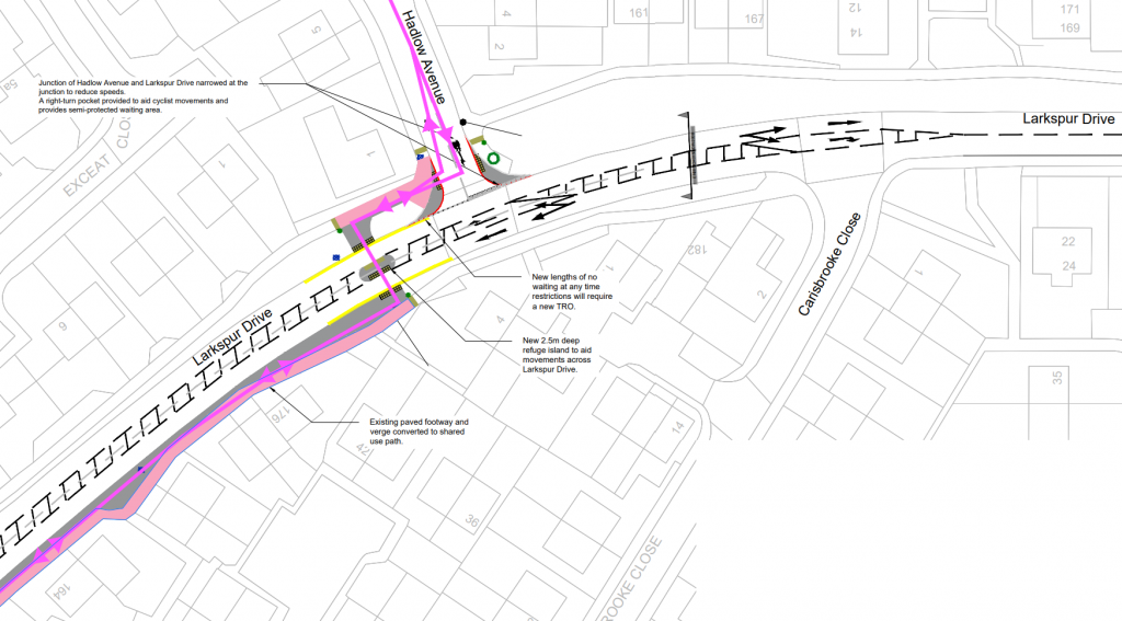
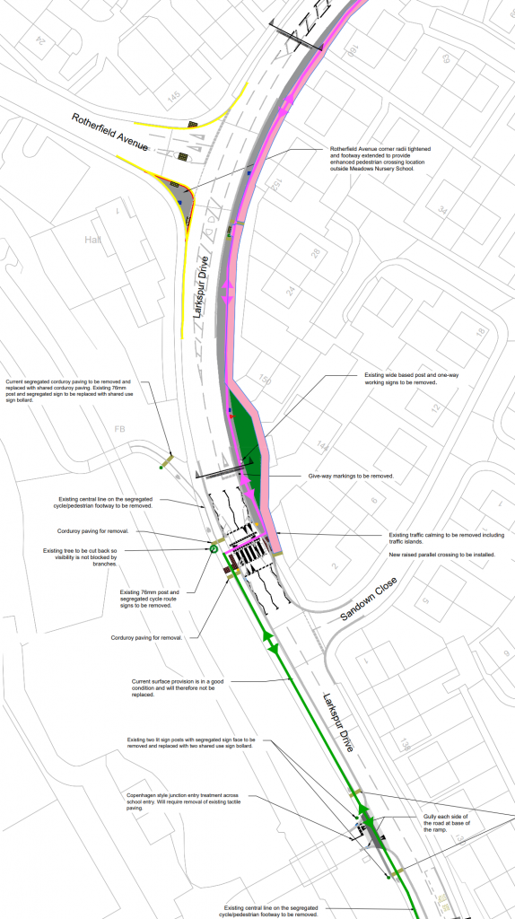
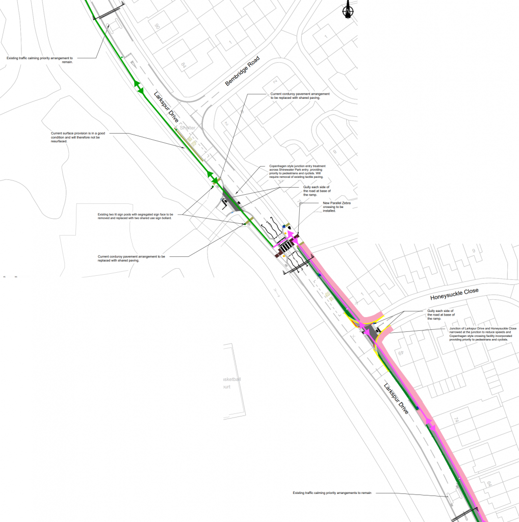
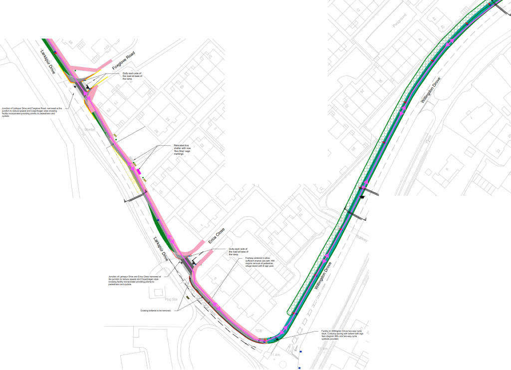
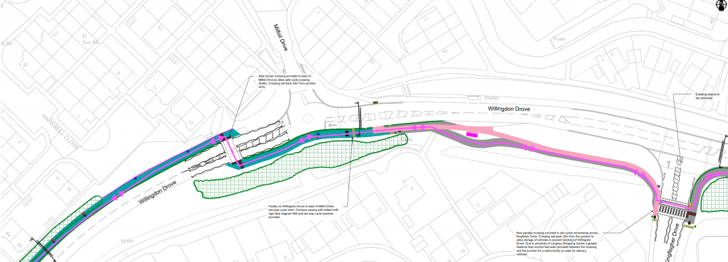
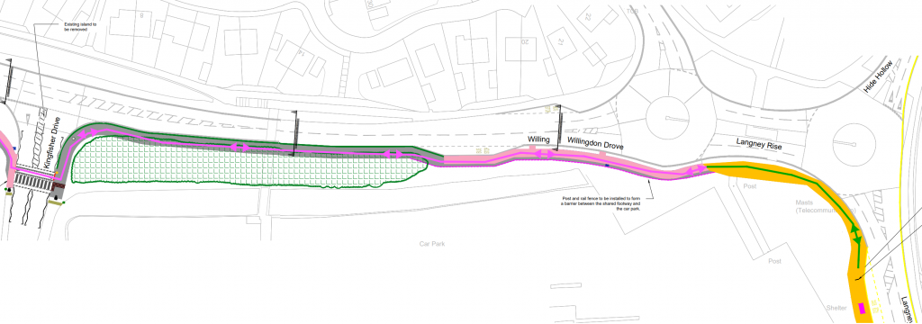
Along Dittons Road, there is a recently created shared cycle way along the northern footway, this is about 3m wide. The changes along this section of road is a reduction in speed limit to 30mph from 40mph. A new parallel crossing is to be provided close to the roundabout, replacing the current dropped kerb island crossing which will be removed. A new cycle/footway will be created around the outside of the South Western quadrant of the roundabout which will be about 4m wide and will involve removing some vegetation. On the Southern arm of the roundabout a raised tabled is to be provided to allow cyclists to travel between the cycleway and the carriageway.The route then requires cyclists to use the carriageway along Adur Drive for a short distance which does also involve navigating a mini roundabout. The Junction of Adur Drive & Tillingham Way will be put onto a raised table, here the path through Adur Park will join the carriageway at the junction. Entering the carriageway here may be difficult if heading North. The route then takes cyclists along Adur Park on a widened path to 4m.The path is widened to 4m through the whole park, except at restraints near the railway underpass. After passing under the railway, the path will connect onto a current turning head on Hadlow Avenue. Double Yellow Lines are to be introduced here to stop vehicles from blocking access to the cycleway. Here cyclists re-join the road network on-carriageway. It has been assessed that low traffic flow and speeds should encourage a safe cycling enviroment.At the Southern end of Hadlow Avenue, the cycle route joins a short section of shared cycleway on the Northern side of Larkspur Drive before crossing over to the Southern/Eastern side at an uncontrolled island crossing (appears 3m in depth). The carriageway will have the two lanes formally marked with a hashed lane in the centre which will be used to provide a right turn pocket into Hadlow Avenue as well as Carisbrooke Close. The kerbs at the junction of Hadlow Avenue will also be tightened to enforce a lower turning speed. The cycle route then follows a widened (4m) shared cycle path along the Southern/Eastern side of Larkspur Drive.The Shared Cycleway heads South along the Eastern side being about 4m wide. The current choke/hump on Larkspur Drive will be removed and instead replaced with a new parallel crossing. This is where the cycleway will crossover to use the current provision on the Western side. The current cycleway on the Western side will have its “segregation” aka white line removed and turned into a shared space. The junction to Rotherfield Avenue will also be tightened to enforce a lower turning speed. The road to the school will have “Copenhagen” treatment so vehicles need to giveway to cyclists and pedestrians crossing.At the current southern end of the cycleway, the raised uncontrolled crossing will be replaced by another parallel crossing to allow pedestrians & cyclists to use the provision on the Eastern side. This again is the footway widened to a 4m shared surface. Treatment for side roads is the same using the “Copenhagen” style. Existing traffic calming measures will remain.The cycleway continues along the Eastern side of Larkspur Drive with “Copenhagen” style junction treatment. Between Erica Close and Willington Drove the carriageway is narrowed to provide for a widened cycleway as there is no verge to widen into. This will result in removal of a traffic island which is current used for pedestrians to cross. Along Willington Drove there is currently no pavements, however there is a footpath on the Eastern side behind vegetation. It is proposed that the Western verge be turned into a cycleway with no foot provision. It will be bi-directional and vary between 2.5m and 3m wide. It will be a continuous route from the shared use path along Larkspur Drive, although it doesn’t appear to be a dropped kerb to change between the carriageway and the cycleway.As Willingdon Drove approaches the mini roundabout with Milfoil Drive, a Toucan crossing will be provided for cyclists to cross to the Southern side of Willingdon Drove. Again this will be on a new cycleway of 3m width. It will become a shared use path again once pedestrians can join via a traffic island on the Eastern side of the mini roundabout. Heading East from here the current footway will be widened as well as a segregated path around the rear of the bus stop. At Kingfisher Drive a parallel crossing will be installed to allow pedestrians & cyclists to crossover to a new shared use path.A new shared use path will be built between Kingfisher Drive and the bus stop, this will be 3m wide and involve removing some vegetation. The footway between the bus stop and existing shared use path will be widened before joining into a current short section of shared use path. This is where it joins into the Langney Rise Scheme.
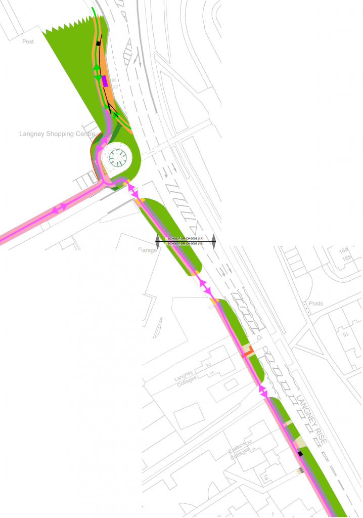
Langney Rise
The Langley Rise section is the worst part of the route, lacking in priority over side roads and segregation.
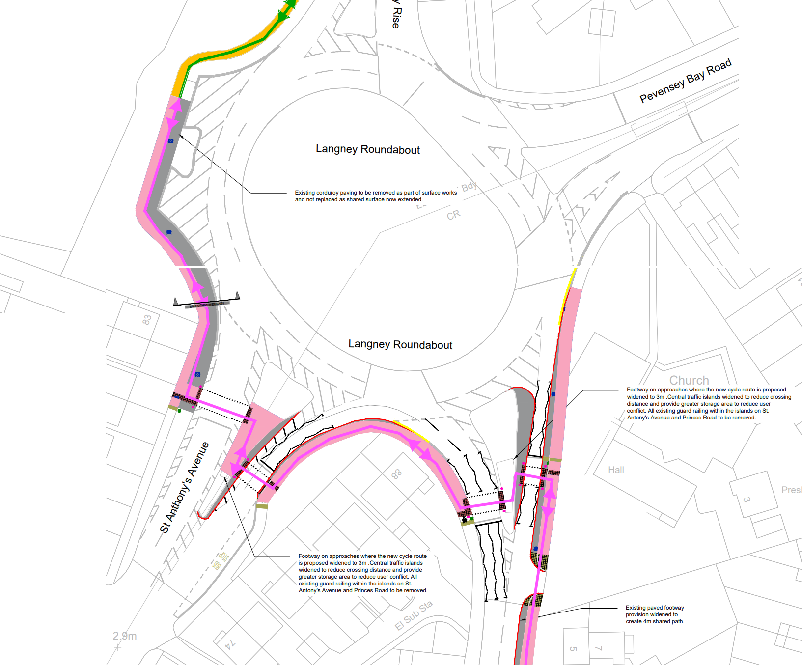
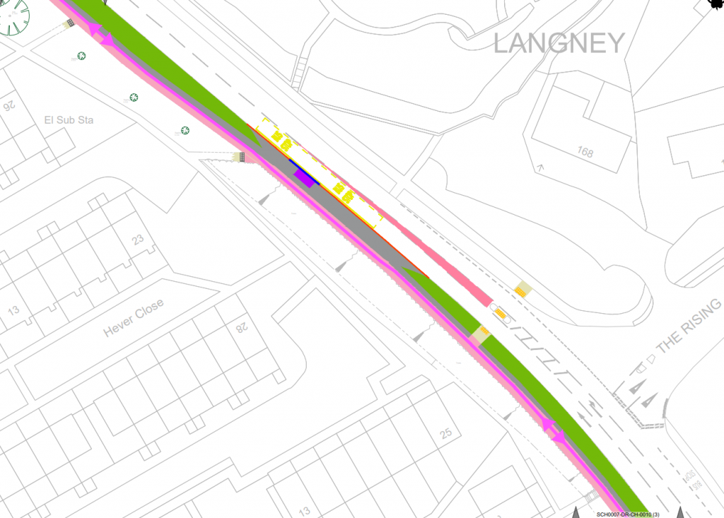
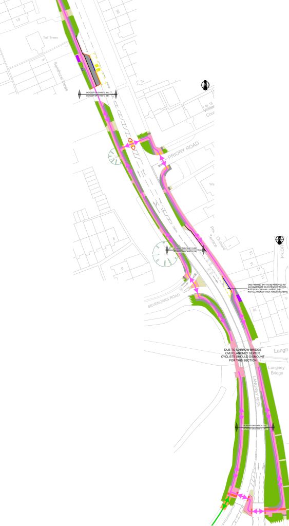
The Cycleway will then head South along the Western side of Langney Rise on a widened footway (est 3.3m). After it goes around the footbridge ramp, it crosses over the sideroads with no priority. A link is provided to the shopping centre.The bus stop opposite The Rising will be taken out of a layby and put in the main carriageway to allow the cycleway to be a sufficient width.The bus stop by Sandhurst Mews is put onto a build out, reducing the conflict between cyclists and those getting on/off busses. North of Priory Road cyclists have the option to use the footway on the Eastern side of Langney Road as well as the Western side. Neither have priority over side roads. The Bus stop opposite Sevenoaks Road is also improved with the introduction of high kerbs. Both footways over Langney Bridge are narrow, no widening will happen here at this time. The traffic signals on the Langney Rise arm of Langney Roundabout will be upgraded to a Toucan crossing to allow cyclists to cross legally. Here the route connects into the Horsey Cycleway.
South of Langney Road
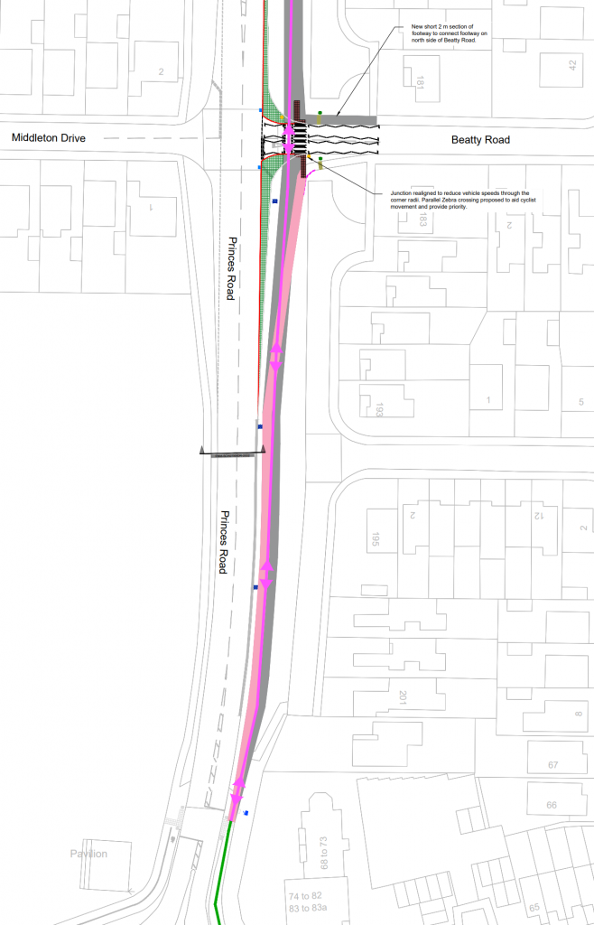
Here the cycleway returns to having good crossing provision of side roads, although is still a shared space throughout
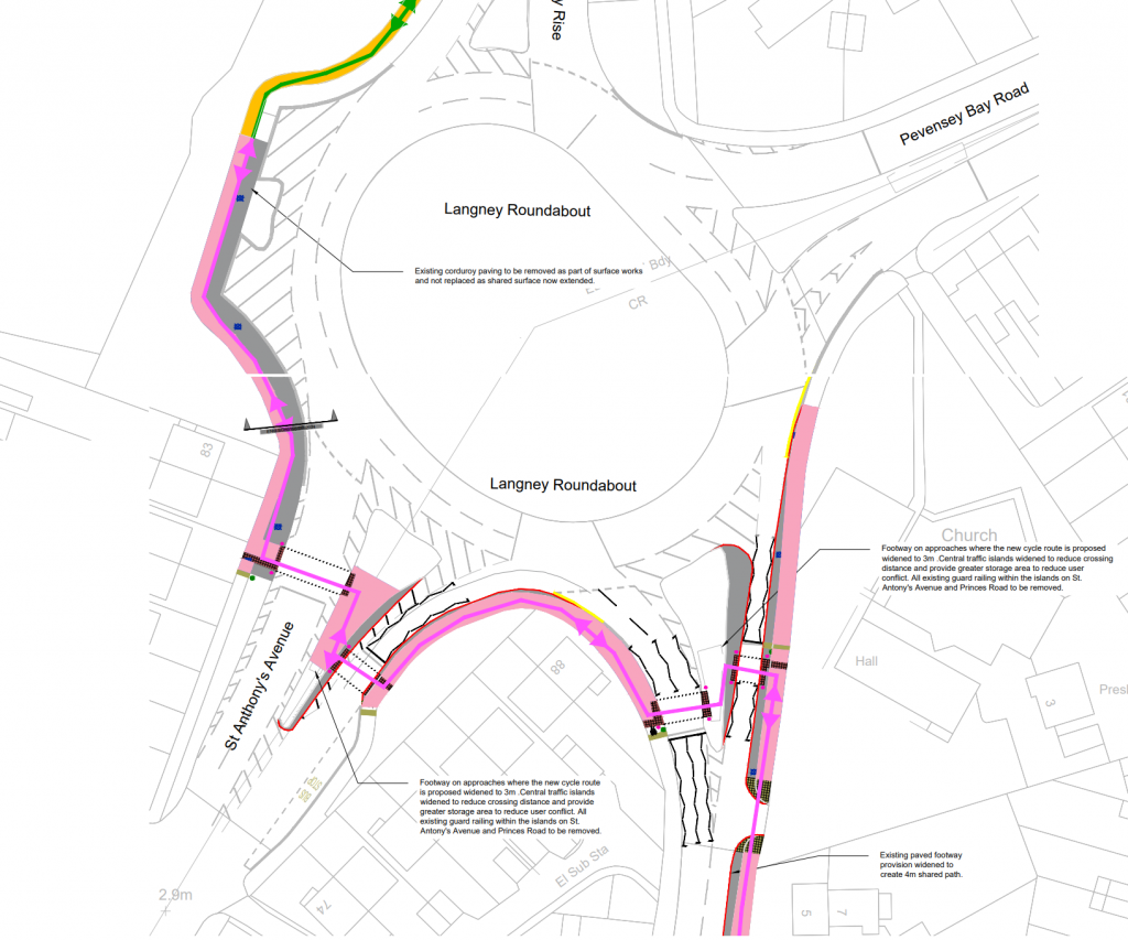
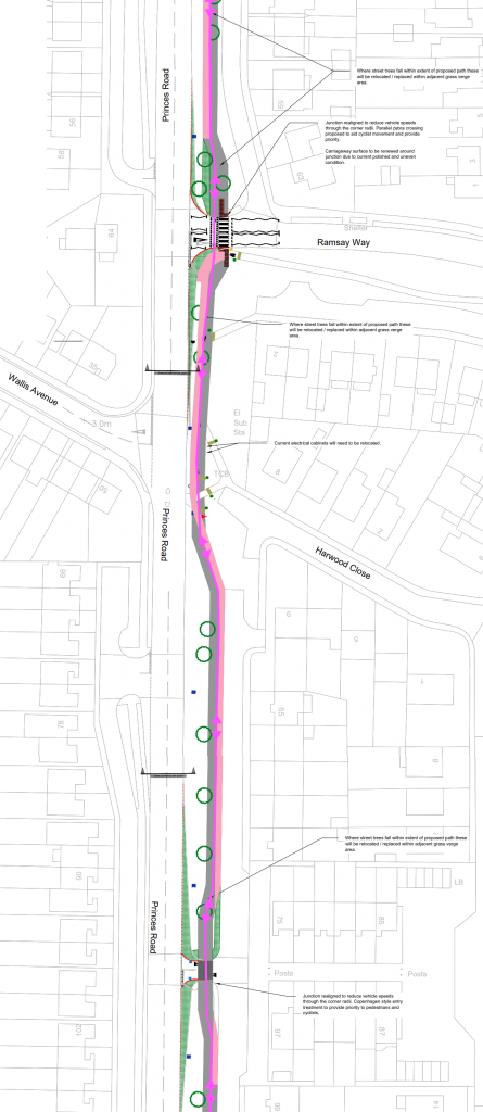
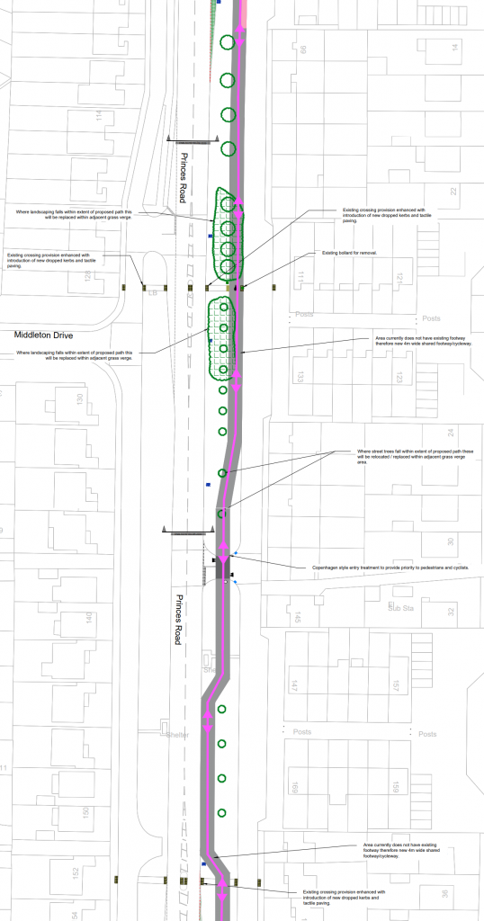
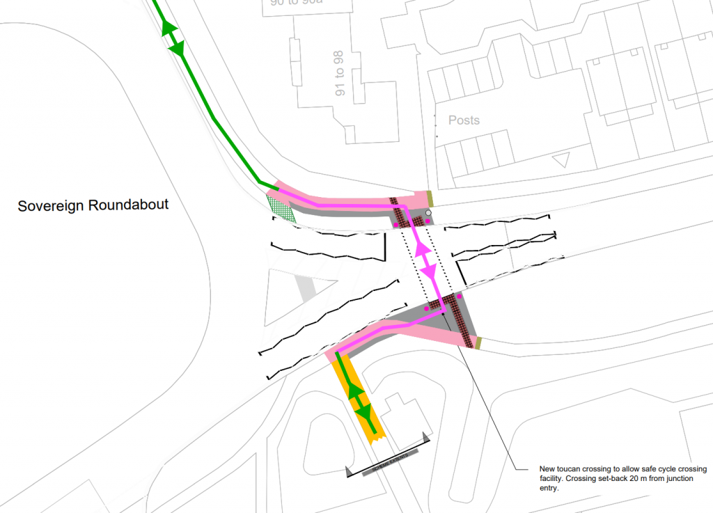
The footway around the edge of the roundabout between Horsey Cycleway and Princes Road is widened and turned into a shared space. The Puffin crossings are upgraded to Toucan crossings and carriageway narrowing is carried out on some exits to provide for the widened footway and/or traffic calming.Heading South along Princes Road, the cycleway continues as a shared space on the Eastern Side as a widened pavement. At Ramsay Way the junction has its radius tightened and the path is set back from the road to provide a parallel crossing, giving pedestrians and cyclists priority. The shared path continues South, however it is lacking access to Harwood Close for cyclists. The junction to the frontage road gets its junction tightened as well however no parallel crossing is provided here, likely because traffic levels are very low. It states there is “Copenhagen” treatment here, but the drawings suggest otherwise.Between Number 99 and Beatty Road there is no footway between the main carriageway and the frontage road, so a new shared cycle/footway will be created. It attempts to avoid removing trees however some will be removed. The junction over access to the frontage road gets similar treatment as the other one. Where there are existing pedestrian crossings over the main carriageway and both frontage roads, tactile paving will be provided.At Beatty Road a new parallel crossing will be added to give priority to cyclists and pedestrians. A short section of footway will also link the current footway on the Northern side of Beatty road to the new cycle/footway. South of Beatty road the current footway will be widened to join in with the current cycle/footway neat to Sovereign Roundabout. The current uncontrolled island crossing of Prince William Parade will be replaced with a Toucan Crossing. This is on the NCN21. The footway between the current crossing and the new crossing will be widened and turned into a shared space. The current cycleway beside the roundabout will not be widened.
Issues
Lack of segregation between pedestrians & cyclists
Where the route isn’t mixed with motor traffic, it is almost entirely mixed with pedestrians. This usually isn’t a problem in areas with minimal pedestrians such as in rural environments, however much of the shared use area would also be subjected to moderate levels of pedestrians.
Lack of priority at junctions
Especially along the Langney Road section, motor vehicles have priority over cycle traffic at junctions. Most junctions & crossings in other areas are better as they often give cycles priority by using parallel crossings of Copenhagen junction treatment.
Narrow Parallel crossings
All of the parallel crossings appear to use the narrowest allowed cycle width of 1.5m, which isn’t recommended for two-way traffic These parallel crossings need the cycle crossing part to be 2.5m or wider ideally where possible.