Between the 19th July and 15th August, WSCC are putting plans for active travel to consultation. This makes up several small schemes across the county to improve the NMU provision in the vicinity to schools. All of the local districts have a scheme except Horsham. This consultation was not announced anywhere, or accessible via the consultation website, its only accessible via a link in the Active Travel Webpage.
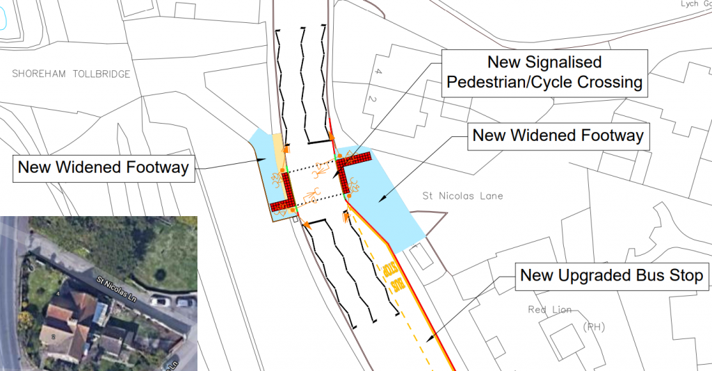
A283 Steyning Road Crossing (Shoreham) – Adur District
This scheme is to introduce a Toucan crossing of the A283 Steyning Road. This isn’t part of the Upper Shoreham Road Cycle track project, however would provide an important crossing as part of the scheme for pedestrians and cyclists to continue to/from the Old Toll Bridge and Upper Shoreham Road. Previously there was no crossing here, however the Active Travel Scheme part of phase 1 did introduce a dropped kerb here. Its unclear how the bus stop is upgraded.
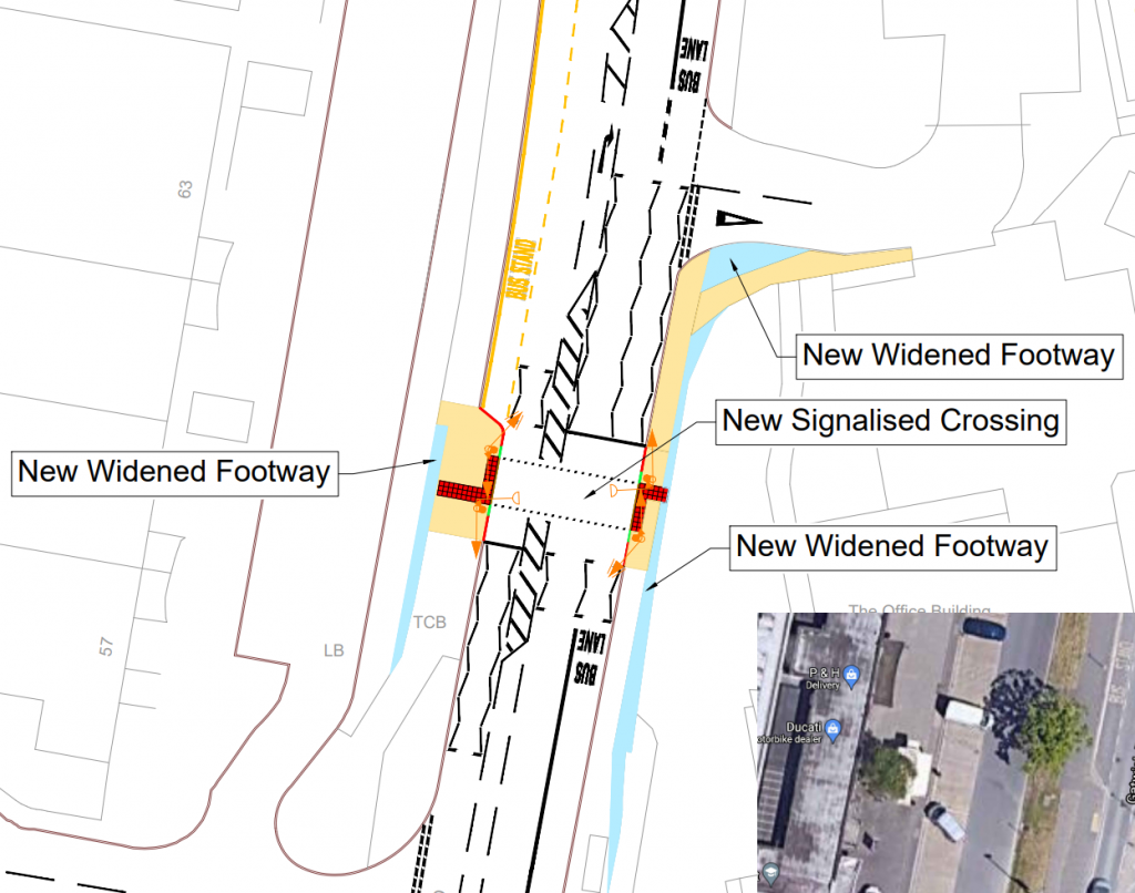
Gatwick Road Crossing (Crawley) – Crawley Borough
The scheme is to replace a current uncontrolled island crossing with an inline Puffin crossing. The side road on the right leads to Gatwick School, and this crossing will allow students to have a safe crossing of the road between the bus stop and the school. There is also additional footway widening. The footway on the Western side is also a cycleway, although there are no improvements to that, despite it being a key route highlighted in Crawley’s LWCIP suggesting it should be widened to 4-5m and segregated by a painted line.
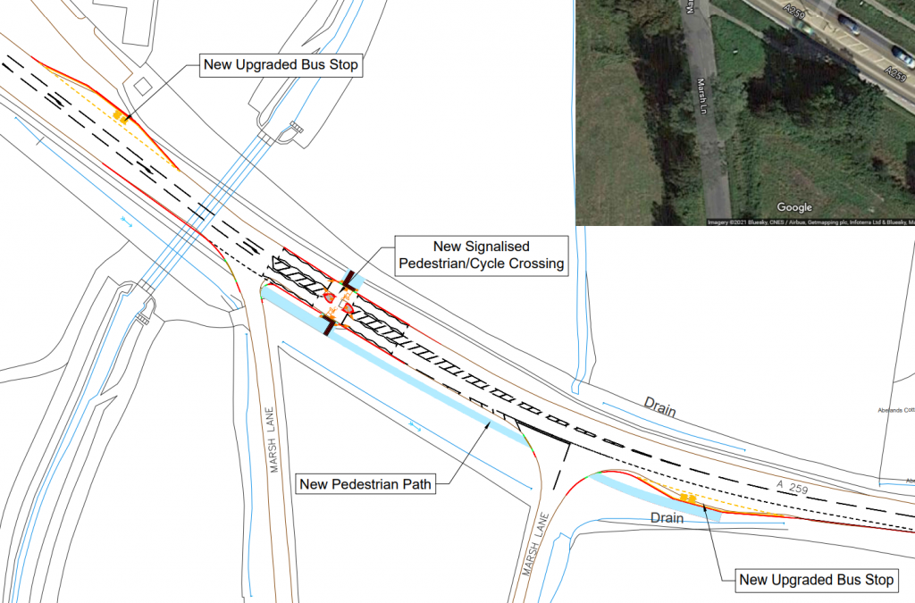
A259 Chichester – Bognor Regis Crossing – Chichester District
An existing uncontrolled island crossing will be replaced with a controlled toucan island crossing. While it will have an island, it will be a single phase to cross the whole road in one go. This will allow the footway on the southern side to have cycle rights to access Marsh Lane (both of them) as well as the bus stop. Both bus stops will also be upgraded to meet current standards.
The road will also be resurfaced to apply high friction surfacing and consideration for a lower speed limit.
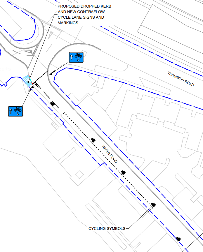
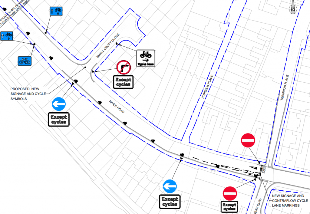
River Road (Littlehampton) – Arun District
Introducing a cycle-contraflow on River Road which is current one-way without any contraflow or cycle provision. River road is a standard width residential road, however one-way to reduce rat running traffic. Road markings and signs along with a dropped kerb to the bridge (part of NCN2) will be provided.
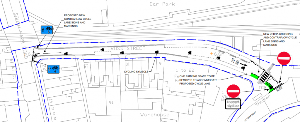
Cross Street (Worthing) – Worthing District
Introduce a cycle-contraflow on Cross Street which is currently one-way without any contraflow or cycle provision. Cross Road is a narrow road with parking provision near to Worthing station. There are some issues with this scheme, that being its end by the station are one-way streets going in the wrong direction for cyclists, so leaving the station you would have to walk to cross street to use the contraflow, and on the western end there are no plans to provide a wigwag for the side road for the level crossing.
There may be other changes in the station area as the planned introduction of a bike hire scheme will put a large bike hub here where 30 bikes can be docked.
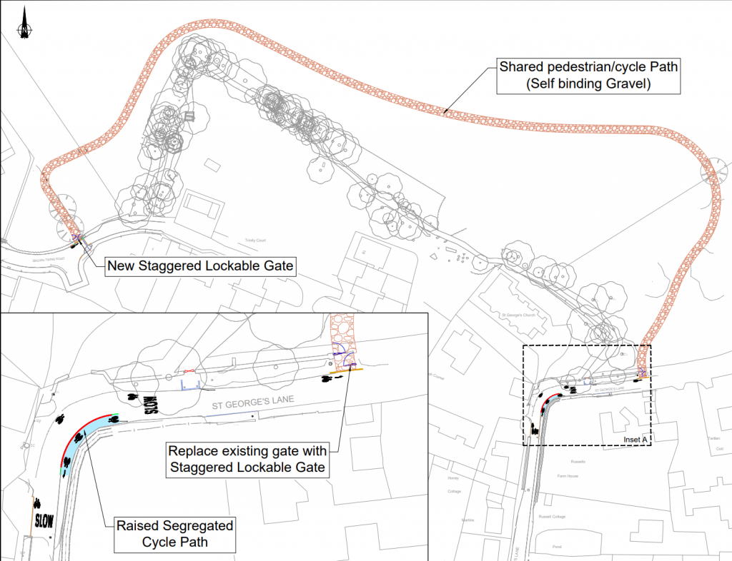
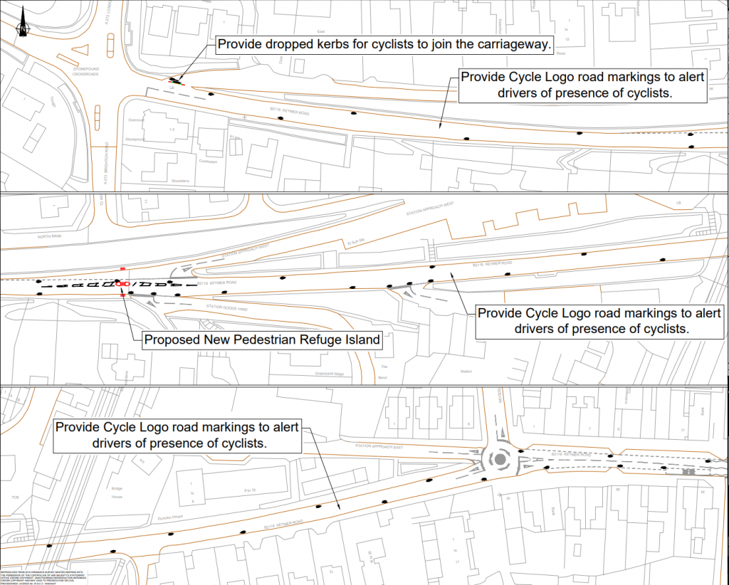
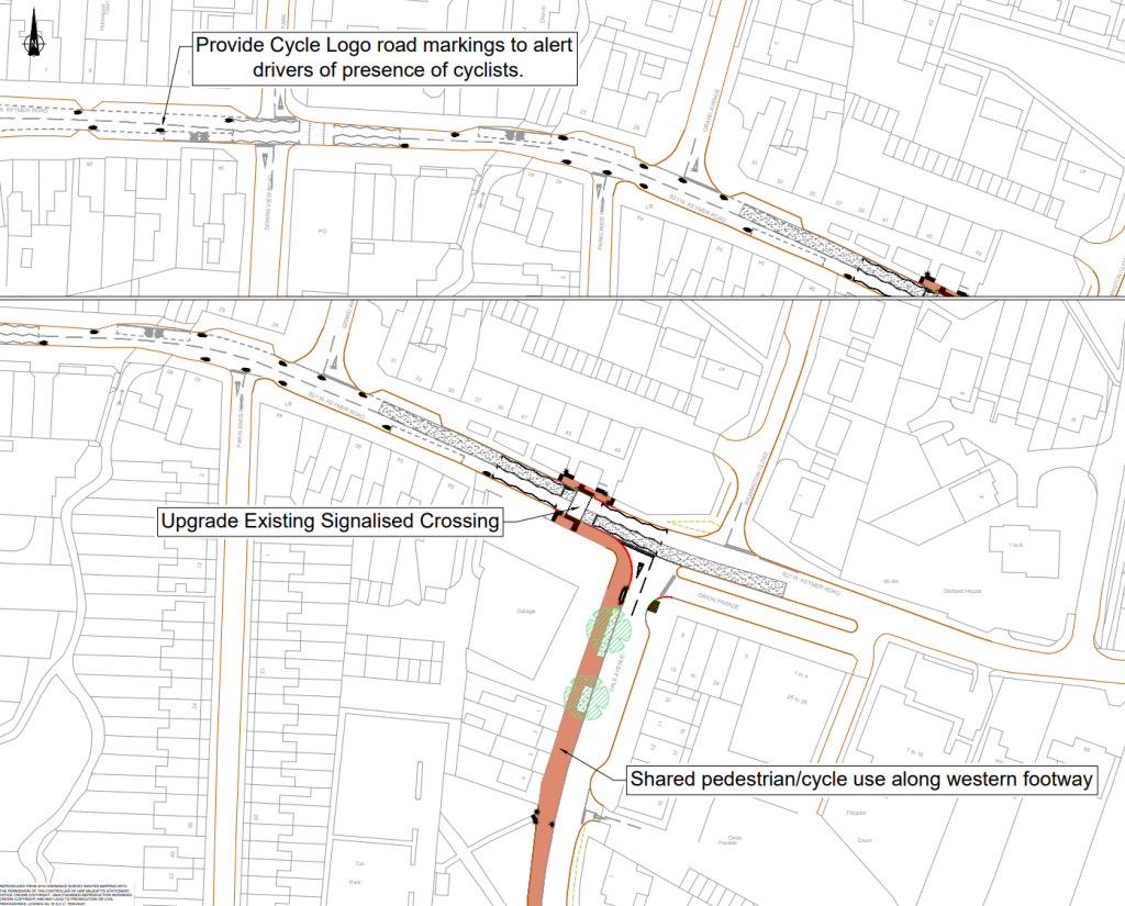
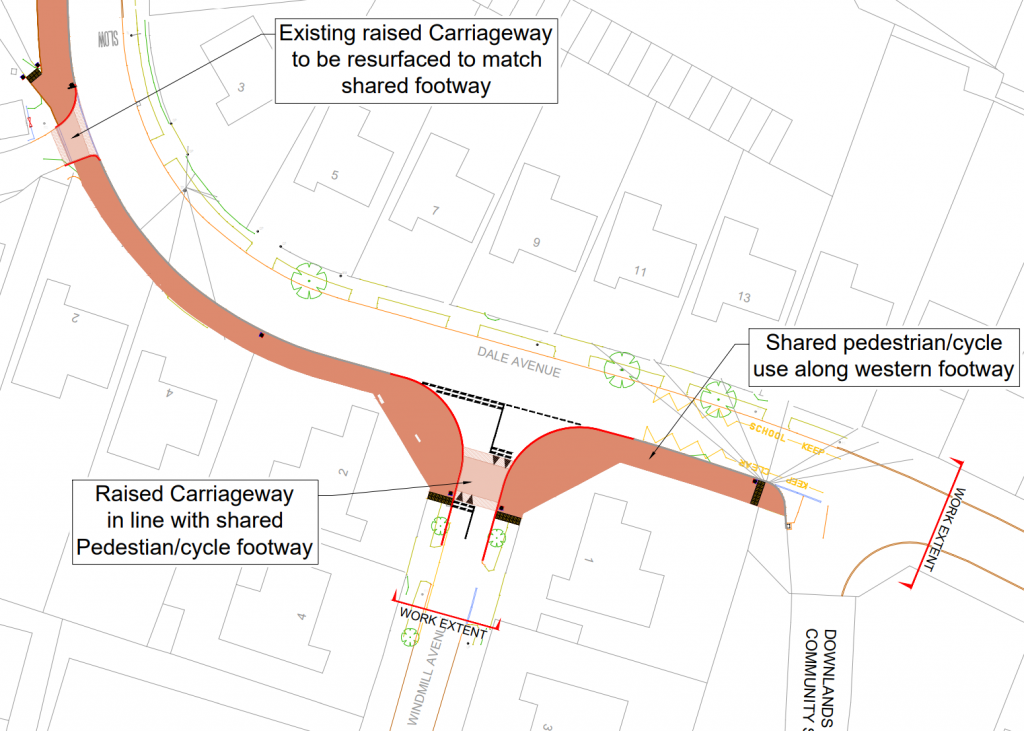
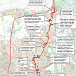
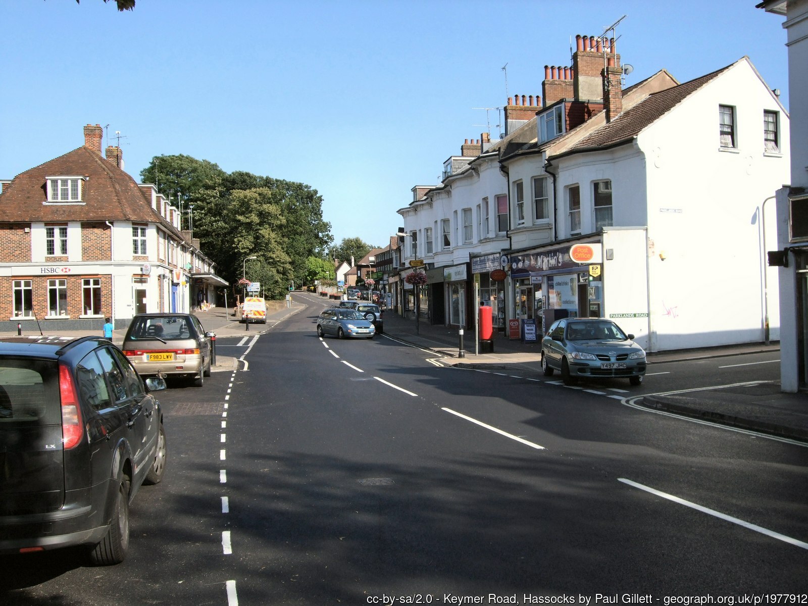
Dale Avenue (Hassocks) – Mid Sussex District
This scheme is the largest of this bunch, it is part of a larger cycle network planned between Sayers Common, Hurstpierpoint & Hassocks, although other parts are planned to be financed internally.