On the 22nd July 2021 the consultation on improvements to NCN2 between Chichester and Emsworth were put to the public. This project is due to be funded by Highways England, however is a WSCC highways scheme. S106 developer contributions may be used to fund part of construction.
The section of NCN2 between Chichester and Emsworth has historically a dangerous gap in NCN2. There is no real alternative route, so the A259 (old A27) got a reduced speed limit and mandatory cycle lanes in places, although these efforts do not meet standards of the NCN and need to be improved. This scheme aims to improve cycling and walking, and also introduce traffic calming through the villages to reduce traffic speed and improve safety.
The Plans
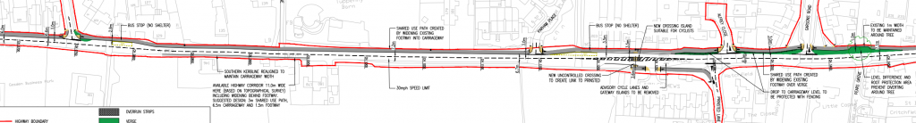
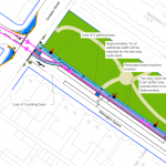
Plans below are East to West (Right to Left), so heading from Chichester to Emsworth.
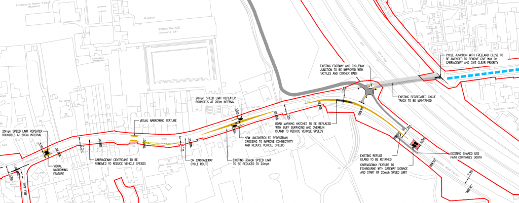
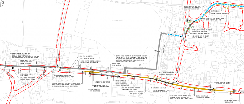
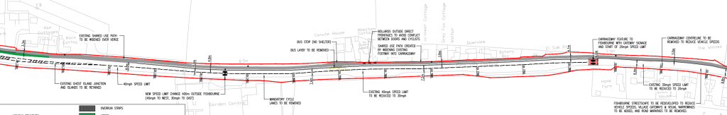
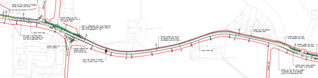
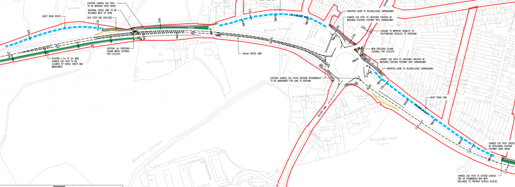
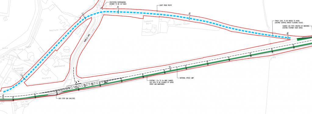
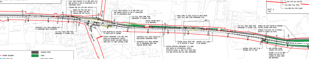
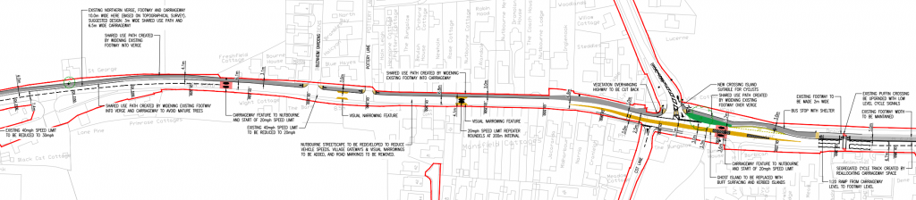
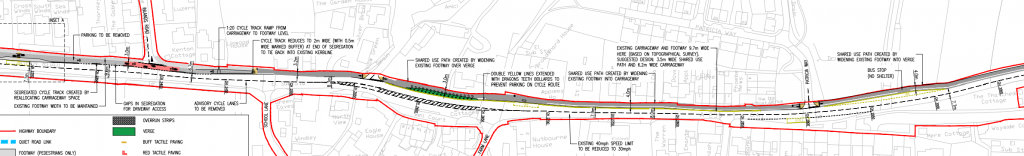
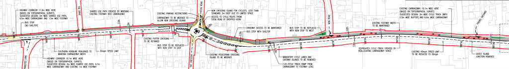
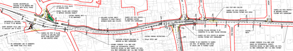
Only minor changes to the cycle provision here, appears to be mostly tactile paving & signage to bring it up to standards. The A259 will receive many changes for traffic calming.Minor changes will be made to the cycle way at Salthill Road, although these changes only appear useful for those going Westbound and in practice may not be used. The addition on new lighting on the off-road sections is a good addition. Where the cycleway runs beside the A259 it is mostly a 3m+ shared surface which should be sufficient, although segregated lanes would be better. Also the cycleway gives way to side roads, while there may not be enough room to kink the cycleway around to provide priority, there should still have an effort made to raise the sideroad.In the rural area towards Broadbridge from Fishbourne, the cycleway remains a shared space ranging around 4m wide. This is good enough for a rural link, although segregation is still preferred.Closer to Broadbridge the shared space reduced to 3.5mIn Broadbridge the NCN2 utilizes the old road alignment. The shared spaces terminate onto the old road, and at the roundabout there will be an uncontrolled crossing across the Northern Arm. To the West side of Broadridge the route joins a shared surface again before splitting onto the old alignment and a 2m shared space on the southern side accessed via an uncontrolled island crossingProvision is provided on the old alignment which is closed to through traffic as well as widened 2m shared space on the southern side (was 1.7m)Through the Eastern part of Nutbourne is where the first part of a 3m bi-direction cycle track is, this part runs for 400m to Drift Lane, where unfortunately it turns back into a shared area to cross over the side road with no priority. However on this bit of segregated cycle track, it does have a floating bus stop, 1 of 2 on this project. On the other side of Drift Lane it becomes a segregated bi-directional cycle track again.The second section of segregated bi-directional cycle track disappears back into a shared space before Broad Road, just 300m later. In this distance there is a Puffin crossing, which will have LLCS installed for the cycle track. The shared space is then between 3m and 4m giving way to side roads.The Shared space continues through Nutbourne until we get to Inlands road where it becomes a segregated bi-directional cycle track with priority across side roads. Here we also find our next and last floating island bus stop.After 550m the segregated bi-directional cycle lane ends as we enter Southbourne. The route then continues as a shared space across side roads, as well as an uncontrolled arm of a mini roundabout.The cycleway then continues as a shared space, ranging between 3 and 3.5m with no priority across side roads.As the cycleway reaches the West Sussex Border, it continues as a shared 3-3.5m space. Although the Pelican crossing will be changed to a Toucan with additional new shared foot/cycleway heading south for a potential future cycle link to Thorney Island.