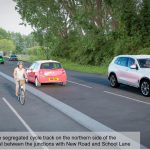
West Sussex County Council has opened a consultation on plans to improve the B2144 to make it easier & safer to cycle & walk along the B2144 from the A27 to the A259 with further connections on either end into the City Centre & the new housing development at Shopwhyke.
A general consultation was held earlier in the year to gauge a view from the public on the following suggestions:
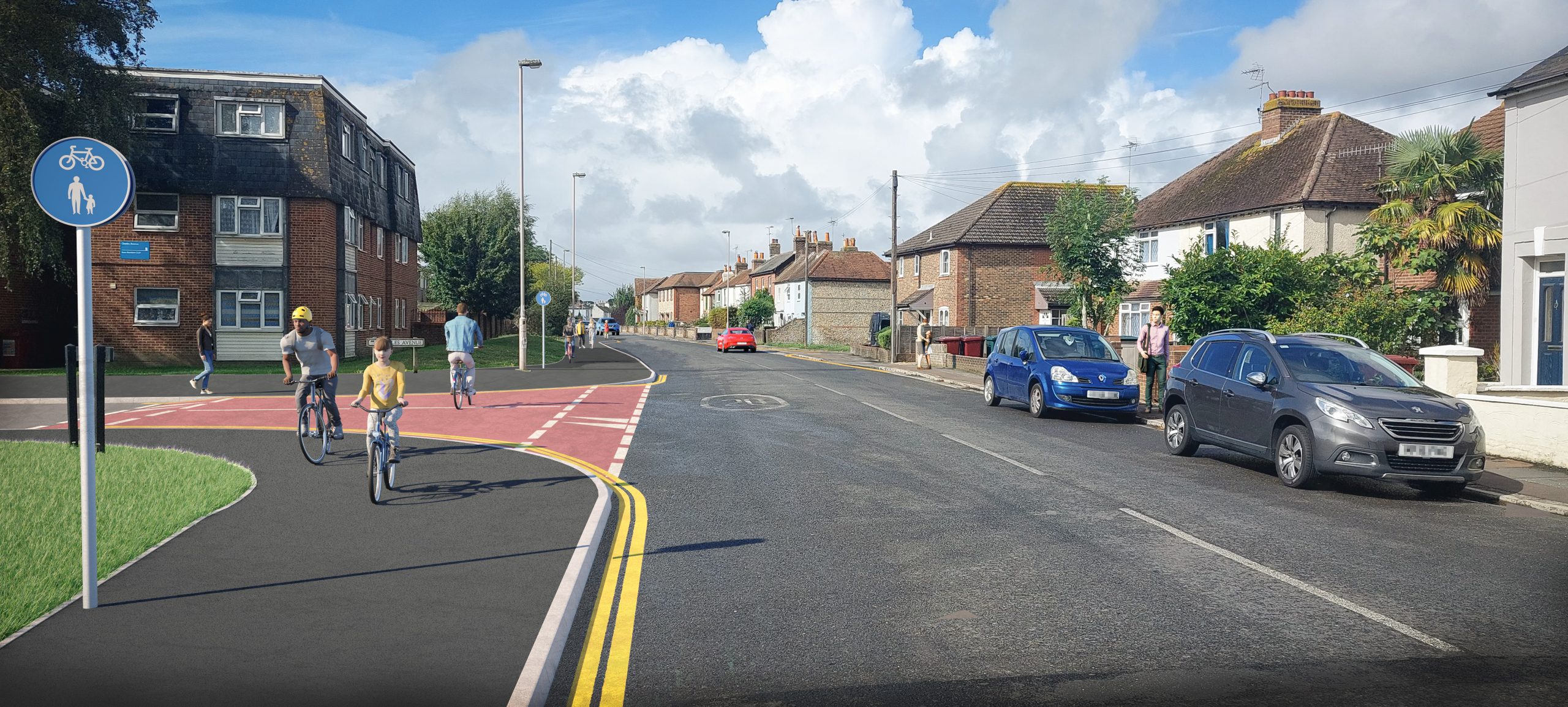
- Dedicated space for cycling
- Wider footways and/or areas of shared space
- Raised tables along some side road junctions to reduce vehicle speeds and make it safer and easier to cross for pedestrians and cyclists
- Converting sections of the road to one-way in order to improve traffic flow.
Overall the responses to this initial consultation pointed at lack of space due to parking & additional traffic along Florence Road due to the current temporary closure of the B2144 at the A27.
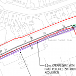
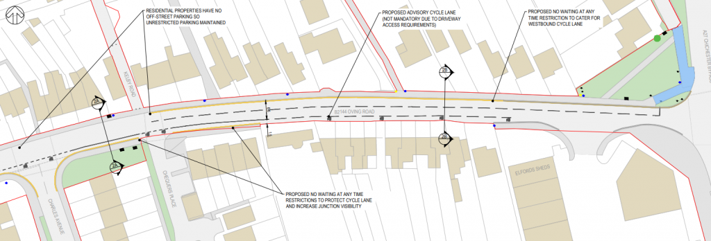
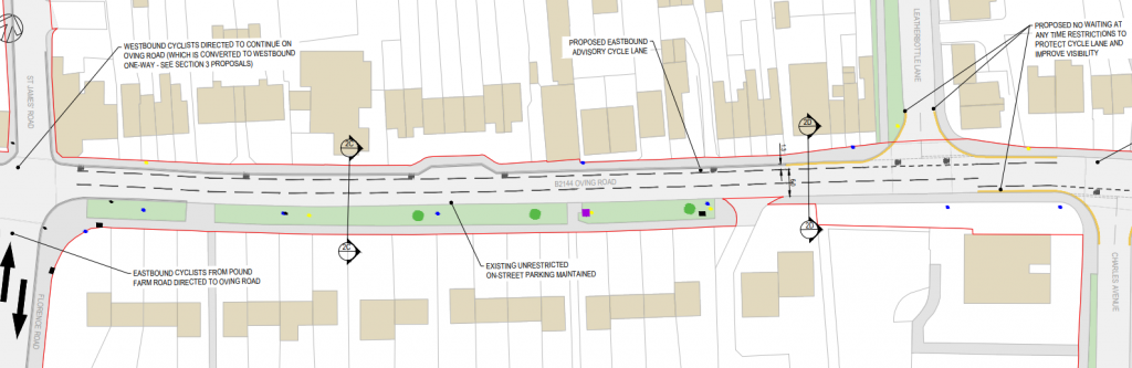
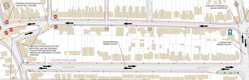
As a result of the initial consultation WSCC is now consultation on two preliminary options along this corridor. The first option uses a shared use path of a nominal width of 3m with a 6.5m carriageway, although in places this does reduce where constrained. The second options provides sections of cycle lane on the carriageway, although due to the width of the carriageway only one direction can be provided for, in additional some sections of road would be made one way for traffic.
Unfortunately there is no option to provide a dedicated cycleway due to width of the highway, although it would be possible to use other options such as a bus gate to reduce through traffic along the road. The road is also a bus route, which would mean making it one-way with a two-way cycle track unfeasible without amending bus routes.
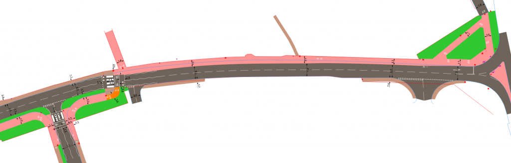
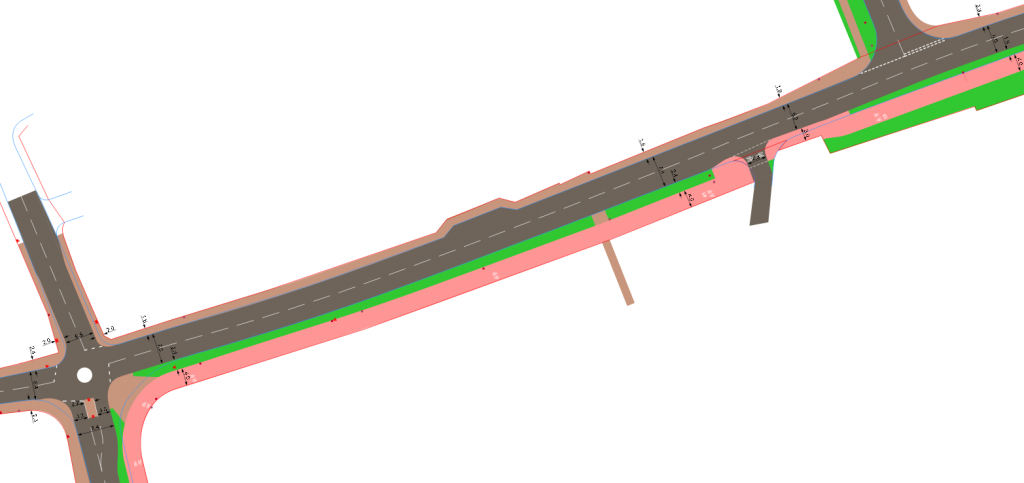
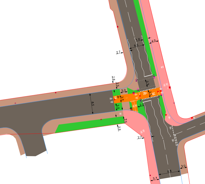
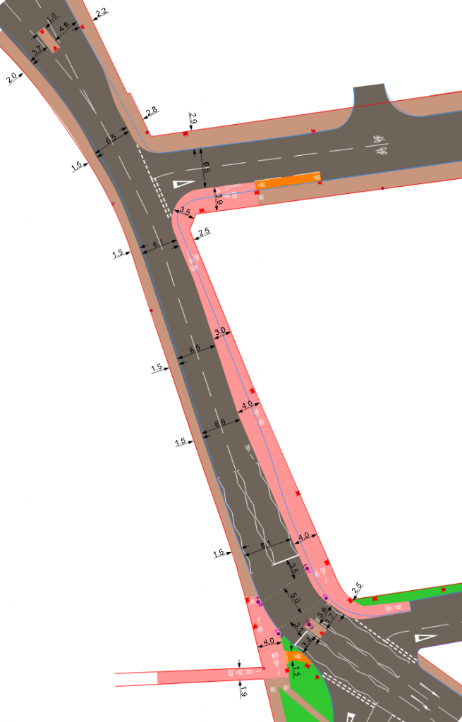
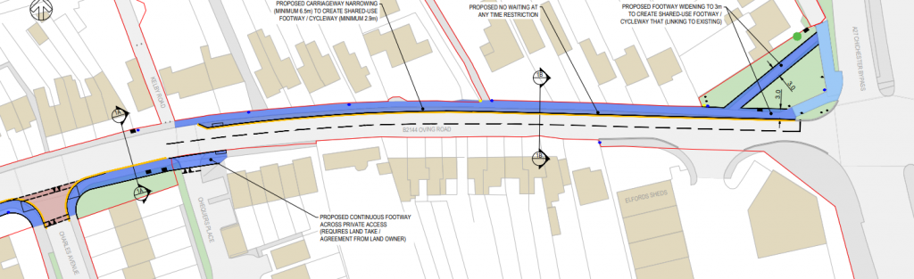
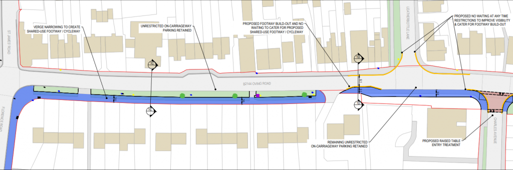
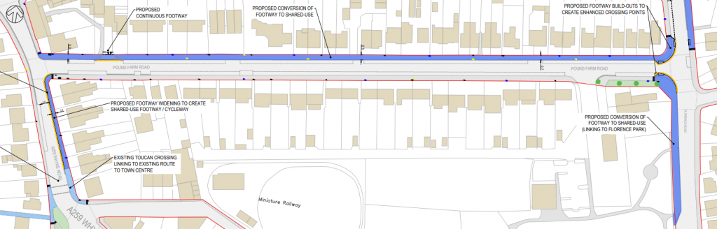
Option 1 Drawings
Option 2 Drawings
Issues and alternatives
Both options do have issues which would make them unattractive. Option 1 uses shared spaces which may put pedestrians and cyclists in conflict, but what makes this worse is the general narrow nature of the proposed route. In a few places it is wider than 3m, but in general it is less than 3m and width adjacent hedges, fences & walls reducing the usable path to less than 2.5m which only just about gives room for two cyclists to pass each other. In some areas the usable area is merely over a meter, which means that two people or cyclists are unable to pass each other. In addition it requires cyclists to cross the road at unmarked crossings several times which is undesirable and may put off younger and inexperienced people from cycling.
Option 2 has more issues. Only parts have painted cycle lanes, which are only 1.5 metres wide with no physical segregation. It also requires those cycling to use a mini roundabout which is discouraged on cycle routes. It would also require cyclists to carry out turns across the A259 at a non-signalised junction or crossing. The second option is not suitable for inexperienced people and would only have a minor benefit for confident cyclists.
We’ve drawn up an alternative option for the route. Its an improved Option 1 using a shared use path along the proposed route. However uses parallel crossings & relocated toucan crossings to provide a continuous and direct route including a modal filter which would need a bus route to be rerouted. This option prioritises having a 4m shared path where a 6.5m carriageway can be accommodated, however in the area of the A259 junction it does reduce to a width under 3metres for a length of 17metres.
Alternative Option