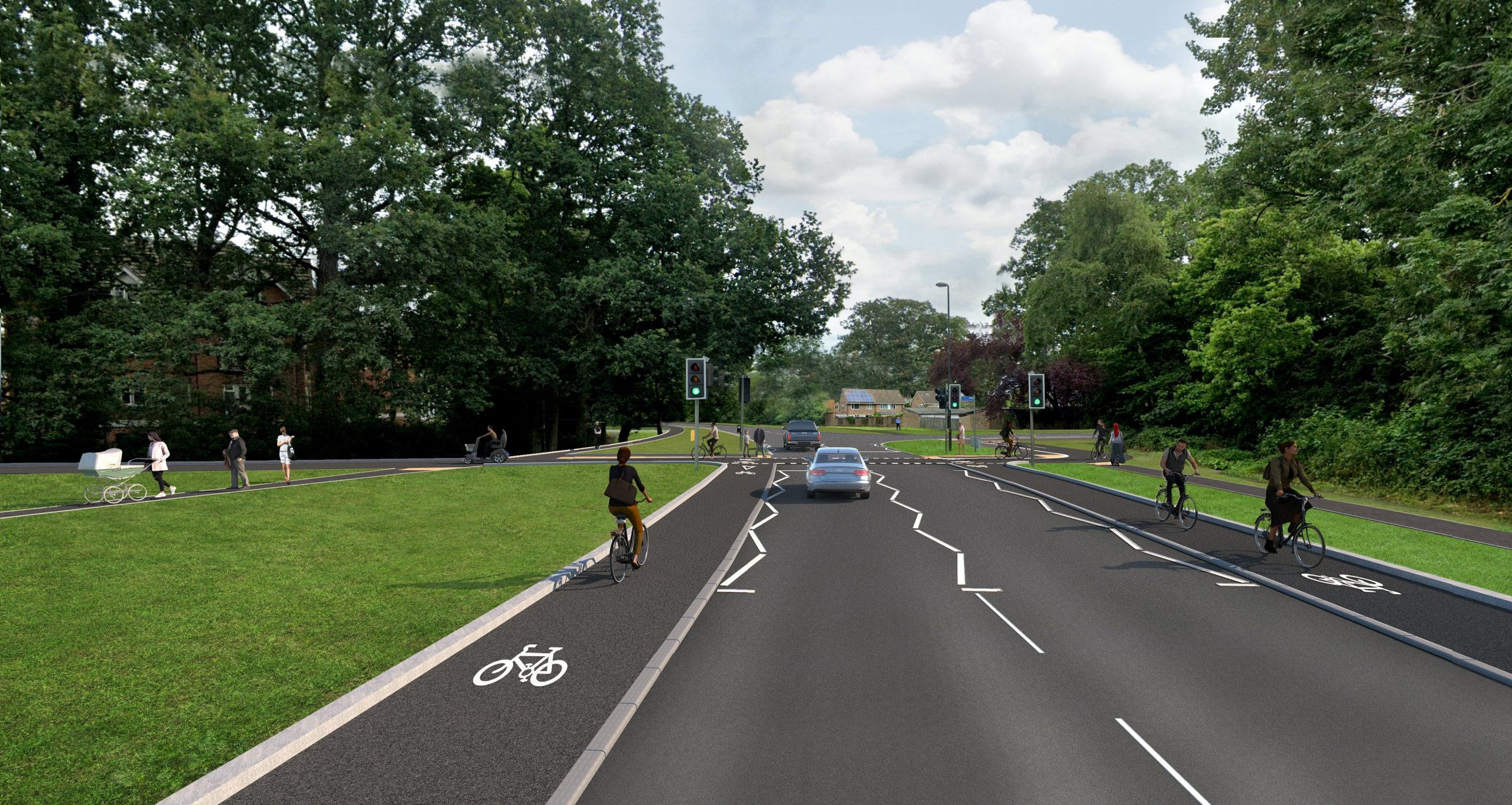
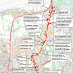
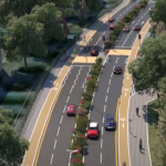
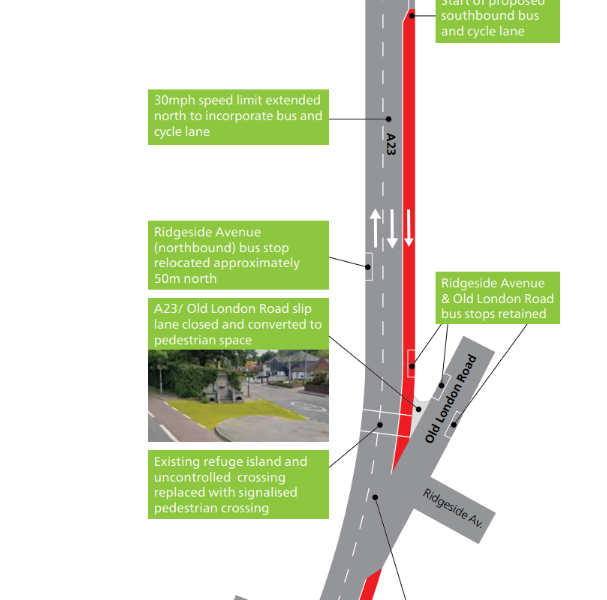
Northgate Avenue in Crawley connects the town centre to the industrial estate and further to the M23 & Gatwick Airport. It is currently a 2 lane 40mph single carriageway road with a 2m side shared pedestrian/cycle track located in a fridge woodland on the Western side of the road. It is proposed to upgrade the road by created stepped- cycle lanes on either side of the carriageway to provide an attractive route for cyclists to use, as well as increasing safety for both pedestrians and cyclists.
The scheme will introduce better crossing points of the A2004, by replacing some of the current island refuge crossings with parallel crossings, the existing toucan crossing would also be upgraded to a signalised parallel crossing.
Further changes would also be made to Woolborough Lane by introducing additional and upgraded crossings points along with dedicated cycling space.
West Sussex CC are currently running a consultation to see what people think of the current plans to develop them further, this consultation runs from the 14th June to the 11th July and can be found here.
The development of this scheme is being funded by the “capabilities fund” which was awarded £150,000 this year, it is expected that WSCC will bid in the Active Travel fund later this year to get funding to deliver this scheme.
The plans
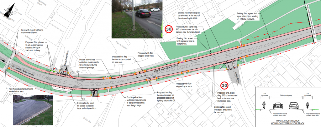
Starting from the Southern end, it will tie into the recently improved highway at Northgatre roundabout. From here northwards it joins the road as a 2m wide stepped cycle lane, separated from the road by a 5cm high kerb. This will be entirely built within the existing verge, so there is no road narrowing except at some junctions.
All junctions will be placed on a table as well as the junction’s radius reduced to lower vehicle speeds and provide for a better pedestrian experience. At the current time, bus stops are proposed to become a bus boarder stop, where pedestrians access the bus across the cycle lane, however subject to consultation, this may be changed.
All refuge islands along this section would remain as refuge crossings. An example of one if these is snow below.
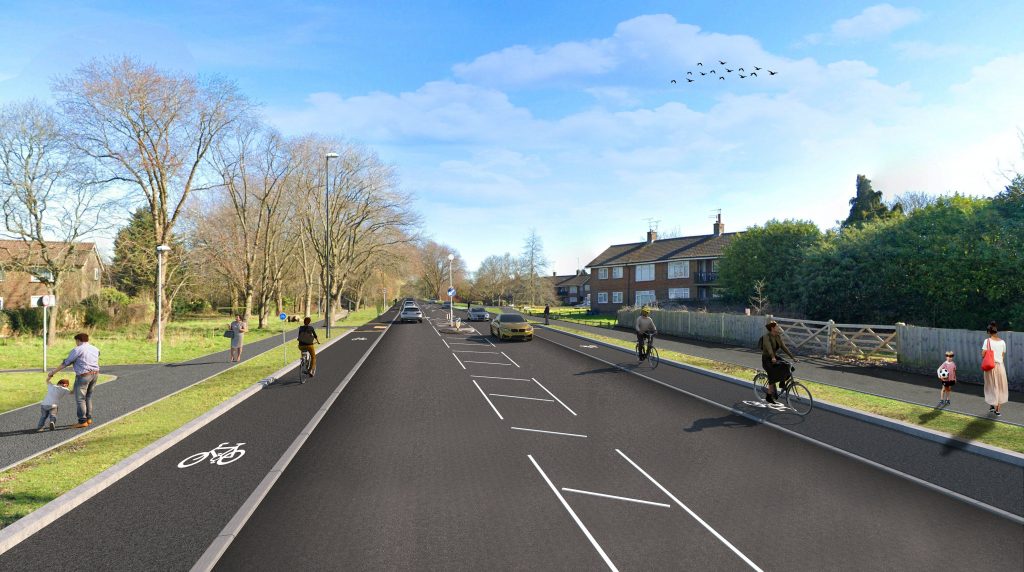
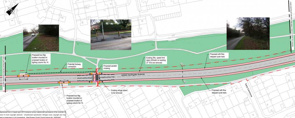
The next section which includes the bus stops will get a parallel crossing. As it is currently designed, it is not good as there is unmarked priority across the cycle lanes. Bus stop locations have not been reviewed on this scheme, which also leads to these bus stops to be floating in random places.
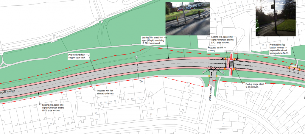
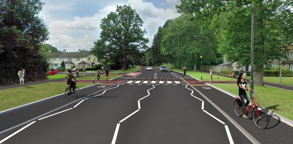
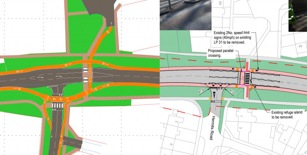
The next section includes the junction with Hermits Road, here the existing refuge crossing would be replaced by a parallel crossing. Below is a render of what the junction would look like.
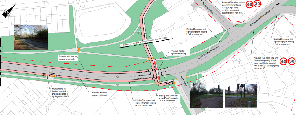
The Northern section of Northgate Avenue would have its current Toucan crossing replaced with a signal controlled parallel crossing. This would then tie into the existing cycle provision on North Road. Heading North-West the current shared use path would be widened to provide a 3m cycle track and a 2m footway. The layout of this crossing is still far from ideal and may change as a result of consultation.
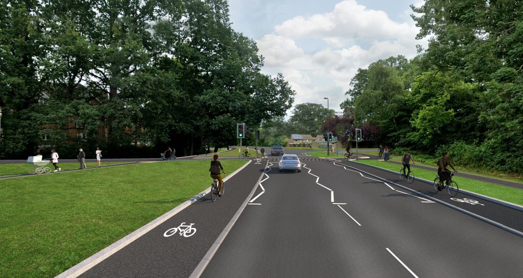
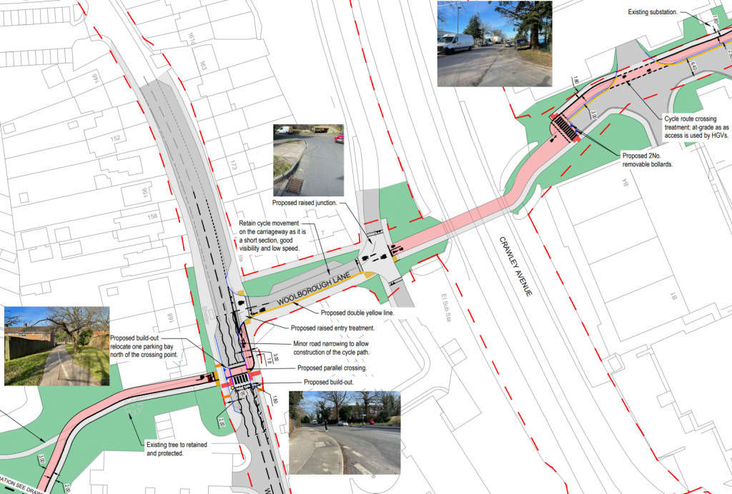
The route will have an improved crossing of Woodfield Way with a parallel crossing before then using Woolborough Lane on-carriageway. Boolborough Lane would also get raised tables at junctions, where it will then use the existing subway under Crawley Avenue (A2011). On the other side of Woolborough Lane, the cycleway would move onto the Western side of the road in a two-way 3m cycle track.
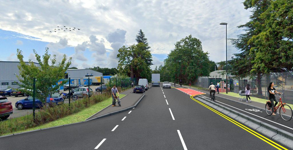
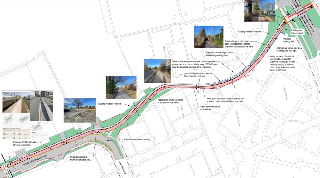
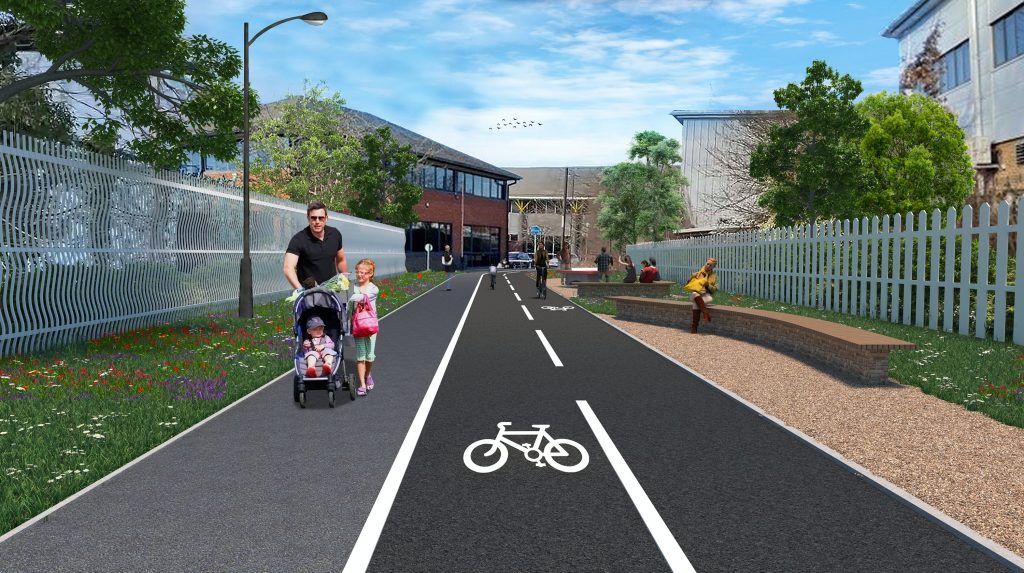
The current path/cycleway connecting Woolborough Lane to Manor Royal will be improved by widening it to hopefully 3m, however some parts may still be only 1.5m due to land constraints.
Overall the plans are good, but the separation and layout at junctions & crossings leaves lot to desire for. For example at Hermits Road, or really any of the junction, although there being a parallel crossing it is not possible to use it marking a right turn onto Hermits Road, plus the cycle lane just go right through the pavement where the tactile paving is. My sketch on the left would be a much better layout as it provides segregation and provides for turning movements.
Download below:
